Project
The first step is to create a project by providing file paths and parameters.
Configuration
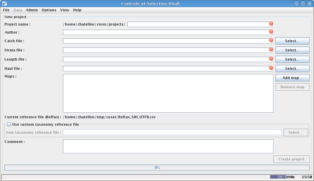
To do so, display the project creation interface using the menu File/New project. The following interface displays :

This interface must contains:
the project name (only alphanumerical characters are allowed).
the name of the author (mandatory!)
The csv files correspond to the 4 data tables (mandatory!)
the maps in shapes format (*.shp) used in the selection step to display the application zone on the world map (optional).
a comment (optional)
It is also possible to use, only for this project, a specific taxonomic reference file instead of the default file which is part of Coser.
Validation
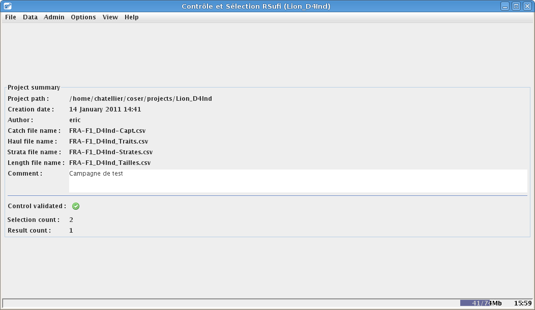
After having clicked on Create project, the 4 data tables and the taxonomic reference file are loaded into memory. The software then checks that the files are in the correct format (CSV, separator, headers names) then creates the project and displays the project summary interface :


